
Click on these sample illustrations, the rest of the maps are listed below:


Click to see each map from the list below for larger image, description, and individual prices:
World: Hemisphere projection
World: Mercator Projection
Animal Kingdom and Productive Industry
Land, Co-Tidal lines, Ocean Currents
Maine
New Hampshire Vermont
New York
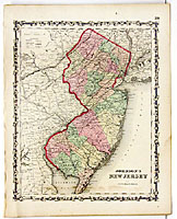
New Jersey
Florida
Kentucky, Tennessee
Ohio, Indiana
Illinois
Missouri, Kansas
Iowa, Nebraska
Minnesota, Dakota
New Brunswick, Nova Scotia, PEI, Newfoundland
Mexico
Cuba, Jamaica, Porto Rico, Bahamas
South America Continent
Europe, Russia
Prussia, Sweden, Norway, Denmark
Germany, No. 1
Germany, No. 2, Germany, No. 3
Switzerland
Italy
Austria, Turkey in Europe
Asia
Turkey in Asia, Persia, Arabia
China
Japan
Australia
Roman Empire, Bible Map